
Top Stories
B.C. South Coast Prepares for Heavy Rain and Snow This Week

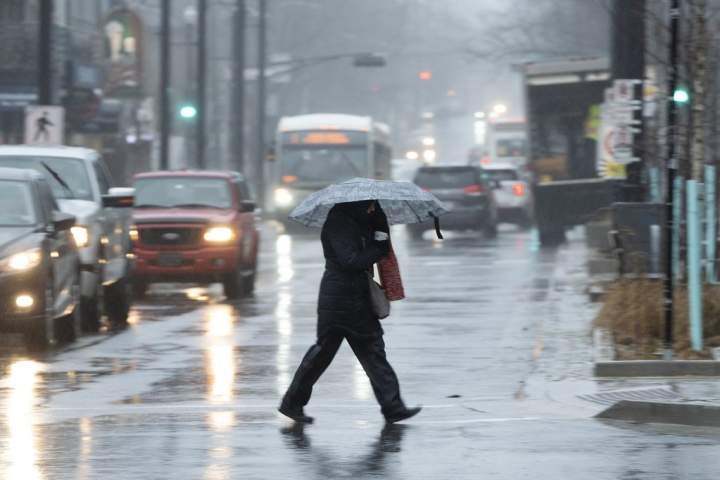
B.C.’s South Coast is preparing for a significant rain and snow event, with forecasts indicating up to 60 millimetres of rainfall in some mountainous areas and 30 to 50 millimetres across the Lower Mainland. Environment Canada has issued a yellow rainfall warning for Metro Vancouver and the North Coast inland, including Kitimat. The weather system is expected to begin on the evening of March 11, 2024, and continue through March 12.
The impending storm will impact several communities, including Vancouver, Burnaby, New Westminster, the North Shore, and areas extending to Coquitlam and Maple Ridge. Higher elevations may experience wet snow, though precise accumulation estimates remain uncertain. According to Environment Canada, snowfall in the North Shore mountains is anticipated to be “significant.”
Meteorologist Kristi Gordon noted that current freezing levels are low, sitting at -2°C on Grouse Mountain. The upcoming system, identified as an Alaskan Low, is moving in from the northwest, which will likely keep freezing levels low as moisture arrives. Gordon emphasized, “The big question is how low the freezing levels will drop.”
Overnight lows are predicted to be around 3°C in Metro Vancouver, meaning the majority of the region will likely receive rain. The yellow rainfall warning indicates the potential for 60 millimetres of rain from Monday night into Tuesday. With temperatures near sea level expected to remain around 3°C, snow levels could drop to between 300 and 500 metres during the night and early morning hours.
In areas near 300 metres, precipitation may result in just wet snow without significant accumulations, while regions at 500 metres could see heavy snow with substantial accumulations and high impact. Gordon explained the uncertainty: “There is a chance the snow level stays just slightly above 500 metres, and no one sees any snow. Conversely, snow levels could drop to 300 metres, leading to a high-impact event.”
Environment Canada has also issued a yellow snowfall warning for the Sea to Sky region, including Whistler and inland areas of the North Coast, such as Stewart and Kitimat. Forecasts predict between 15 and 20 centimetres of snow, with some areas receiving up to 25 centimetres. Snowfall is set to begin around midnight on March 11 and is expected to intensify by Tuesday morning, continuing intermittently until late Tuesday afternoon.
Travelers are advised to exercise caution during this period, allowing extra time for their journeys as road conditions may deteriorate due to rain and snow. As communities brace for this weather system, local authorities are prepared to respond to any challenges that may arise due to the storm.

Meta Plans Major Layoffs as AI Costs Surge

Alberta’s Referendum Could Pave Way for U.S. Statehood

Minooka District 201 Plans Enhanced Bilingual Support for Students

Canmore Approves Multiple Development Permits for New Projects

Remembering Bradly Castillo Shearsmith: A Life of Friendship and Joy

BIS Urges Watchdogs to Integrate Synthetic Risk Transfers in Stress Tests

Teva Transforms: Shifting Focus from Generics to Branded Success

Apple Launches AirPods Max 2 with Enhanced Audio Features

Ontario Ends Funding for Seven Supervised Injection Sites

Toyoake City Proposes Daily Two-Hour Smartphone Use Limit

Pedestrian Fatally Injured in Esquimalt Collision on August 14

B.C. Review Reveals Urgent Need for Rare-Disease Drug Reforms

Dark Adventure Game “Bye Sweet Carole” Set for October Release

Konami Revives Iconic Metal Gear Solid Delta Ahead of Release

Victoria’s Pop-Up Shop Shines Light on B.C.’s Wolf Cull

Jimmy Lai’s Defense Challenges Charges Under National Security Law

Snapmaker U1 Color 3D Printer Redefines Speed and Sustainability

Apple Expands Self-Service Repair Program to Canada
-
 Science1 year ago
Toyoake City Proposes Daily Two-Hour Smartphone Use Limit
-
 Top Stories1 year ago
Pedestrian Fatally Injured in Esquimalt Collision on August 14
-
 Health1 year ago
B.C. Review Reveals Urgent Need for Rare-Disease Drug Reforms
-
 Technology1 year ago
Dark Adventure Game “Bye Sweet Carole” Set for October Release
-
 Technology1 year ago
Konami Revives Iconic Metal Gear Solid Delta Ahead of Release
-
 Lifestyle1 year ago
Victoria’s Pop-Up Shop Shines Light on B.C.’s Wolf Cull
-
 World1 year ago
Jimmy Lai’s Defense Challenges Charges Under National Security Law
-
 Technology1 year ago
Snapmaker U1 Color 3D Printer Redefines Speed and Sustainability
-
 Technology1 year ago
Apple Expands Self-Service Repair Program to Canada
-

 Technology1 year ago
AION Folding Knife: Redefining EDC Design with Premium Materials
-

 Technology1 year ago
Solve Today’s Wordle Challenge: Hints and Answer for August 19
-

 Business1 year ago
Gordon Murray Automotive Unveils S1 LM and Le Mans GTR at Monterey